2000/02 Australia trip - Strahan |
|||
There was no point in looking at mountain views through the mist, but we stopped off at various hikes, along the Franklin River and to Nelson Falls. This area is being battled over by conservationists and by power engineers who want to dam the river and flood the Franklin watershed. It’s dense rainforest, much like Vancouver Island, but with even stranger plants and mosses, a really green jungle.
 |
Franklin River (2.41) | 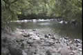 |
|---|
|
Nelson Falls (4.01) | 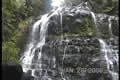 |
|---|
We eventually dropped down into Queenstown after lurching around miles of twisty and bumpy road. This was the site of a large copper mine and it’s now both polluted and depressed, not a pretty place, rather dead on a wet Saturday afternoon.
|
Strahan (5.54) |  |
|---|
We carried on down to the seaside at Strahan, pronounced Strawn. Strahan is in a natural harbour on a very dangerous coast. The next piece of land to the west is Patagonia in South America, so the wind and waves have 8000 miles to get up to speed. The campground in town looked OK but rather uninteresting so we drove out to Swan Basin and Macquarie Heads at the mouth to the harbour. There was supposed to be a campground there but it turned out to be a shanty town at the end of a rotten road, so we gave up and went back to town. We ate at the only place in town, the pub. The weather had dried up by now, but was very windy, with a few holidaymakers in placky macs leaning into the wind. Memories of Bognor.
Sunday January 30th
Early next morning we headed out into Macquarie Harbour on the Wanderer III, a big catamaran. Luckily the wind had dropped and it was warm enough to go out on deck. Although the harbour is safe, getting in and out is not. The entrance is only a few dozen yards wide, with cliffs on one side and a sand bar on the other, so we heard lots of stories 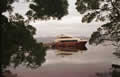 about ships that didn’t make it. The skipper said that there used to be a wave meter there and it registered sixty foot waves just before it was destroyed in a storm. The convicts used to call it the Gates of Hell, but that was because the prison was just inside the harbour.
|
Macquarie Harbour (33.08) |
.jpg) |
|---|
The prison was on Sarah’s Island, and the convicts were put to work building ships out of the Huon pine that grows in the area. Huon pine is very hard, resists rot for a hundred years, and the trees take about a thousand years to reach maturity. Our guide on the island was an actress, very expressive, who described life on the island from the point of view of the convicts and the soldiers guarding them. For a finale, she stripped down to a wet suit and dived into the water to show us the foundations of the slipway, built from Huon pine and still in place after 170 years.
Sarah’s Island was abandoned eventually because of the difficulty of sailing against the wind from Hobart, and all the convicts were transferred to Port Arthur. Back in England it had a fearsome reputation because of its remoteness, surrounded by sharks and jungle and undrinkable black water. In reality. there are few if any sharks, and although the water is brown (from tannin in the vegetation) it is drinkable, just like the water in northern Minnesota.
The boat had a frothy brown wake as it took us up the Gordon River to where there’s a walkway through the Huon pine forest. The forest grows to the river’s edge and looked to be very difficult terrain. There are no roads or trails in this area, so it’s as wild as it was before the aborigines came. Some people believe that there are still Thylacines (Tasmanian tigers) in this area, but no one’s proved it.