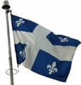
 Shortly afterwards, we crossed
from Ontario into Quebec, and, immediately, French was the only
language . Ontario is bilingual, so it has umpteen road signs, some
half in English, half in French, but at least they do have English.
Also, the only flag visible is the Fleur de Lis, with no sign of the
Canadian maple leaf. Back in the 1980s Quebec had a law that made it
illegal to have public signs in English, so a company called, say,
"Steptoe and Son" would have to change the company name
plate to "Steptoe et fils" or pay a fine. That law was
eventually repealed but I've heard since that web sites hosted in
Quebec have to have French text even if they are intended for the
American market.
Shortly afterwards, we crossed
from Ontario into Quebec, and, immediately, French was the only
language . Ontario is bilingual, so it has umpteen road signs, some
half in English, half in French, but at least they do have English.
Also, the only flag visible is the Fleur de Lis, with no sign of the
Canadian maple leaf. Back in the 1980s Quebec had a law that made it
illegal to have public signs in English, so a company called, say,
"Steptoe and Son" would have to change the company name
plate to "Steptoe et fils" or pay a fine. That law was
eventually repealed but I've heard since that web sites hosted in
Quebec have to have French text even if they are intended for the
American market.
We had no interest in going into
Quebec's cities on this trip, so we skirted Montreal, crossing to the
south side of the river. The main scenery there is a forest of power
pylons taking Quebec Hydro's electricity down south to New York. The
freeway took us through about 150 miles of farming country towards
Quebec City. As we did so, the temperature dropped steadily into the
fifties, and we were soon driving through wet fog. We were heading
for Jacque Cartier national park which is north of Quebec City, so we
had to go back across the river and then we ran into the city's rush
hour and crawled our way along a series of clogged freeways. North of
the city we started climbing into the mountains past the town of
Stoneham-et-Tewkesbury. This is a strange name given that almost all
the other towns are called Saint-This or Sainte-That, and I can only
assume that some Gloucestershire immigrants named the place before
they were ousted by the Frenchmen.