2006/01 Southwest USA trip (MN-TX) - Grapevine Hills, Big Bend |
|||
We headed off towards Big Bend, stopping at the Pecos River for lunch. We met up with a German there who remembered 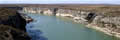 reading about Pecos Bill when he was a kid. (I remembered it as Pecos Pete, but this is definitely cowboy history area.) He was driving a Fiat motorhome that he’d imported from Germany. He was intrigued with our Tiger motorhome, and was looking forward to using something like it for a trip to Argentina and Chile.
Soon after we got to the town of Langtry, which looked like it had seen better days, as most of the buildings were derelict. This 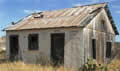 was the town created by Judge Roy Bean, a saloon owner, con man, and the only judge in the area. He’s known affectionately as the “Hanging Judge”, but in reality he never executed anyone and is more justly famous for his humour and his rough and ready form of justice. He named the town after his favourite pinup, Lillie Langtry.
Soon after, we were stopped at an immigration checkpoint, and the guard decided we were not Mexican wetbacks and let us continue. This was the first of a number of such stops, as the Border Patrol has checkpoints on all the major roads that are close to the Mexican border. Sandie had found a Guatemalan 5c coin at Amistad, so it’s probably a good idea to have the checkpoints.
As we drove west, the towns were increasingly decrepit, with closed-down stores and gas stations. The scenery too was becoming drier, with few trees, just the occasional shrub and mesquite feeding skinny cattle and goats.
We refueled at Marathon, another half-dead town, and headed south towards the park, across seventy miles of empty country, bordered by steadily higher mountains. The scenery became greener and more diverse as we crossed into Big Bend park and left the cattle and goats behind.
 The sun had set by the time we made it to the Visitors Centre, but we were just in time to be allocated a backcountry camping site. These are out in the desert or mountains and are free. To get to ours we had to bounce along eight miles of rough track into the Grapevine Hills but we were in the kind of country we love. We arrived in the dark, but we had a nearly full moon to help us on the last couple of miles.
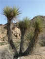
Big Bend, with its isolated backcountry campsites and rough roads, is just about the perfect spot for our Tiger. The national park is quite large, about 50 miles by 50 miles. Most of it is desert, the northern end of the Chihuahuan desert which stretches down into Mexico. In the centre of the park are the Chisos mountains which being thousands of feet higher are much cooler and damper. Animals and plants that thrive up there are essentially on an island as they can’t cross miles of hot, dry desert to other mountainous areas. The park is bordered on the south by the Rio Grande river which is also the border with Mexico, and two great mountain ranges the Sierra del Carmen and the Sierra Ponce. The result of all these extremes is one of the country’s most interesting and rugged national parks.
Thursday January 12th
It was a warm night and the furnace didn’t run at all. I went for an early-morning walk amongst the cactus and 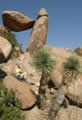 found that it’s true that in the desert everything either punctures, stings, bites, or poisons. Shorts and sandals don’t really work too well! To be fair, there are a few harmless shrubs: creosote bush, snake bush, and mesquite, but very often there’ll be a cactus or thorn bush lurking inside or under one of them.
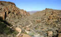 We drove a little way back up the road to the Grapevine Hills trailhead, and then hiked up to the pass. This is great scenery, cliffs of big volcanic rocks looking down on the hikers. It’s a scramble at the end to climb up to the pass, and then there’s the “balanced rock” a perfect window of rock opening out onto another valley of rocks. We spent a lot of time setting up for a postcard picture, but it was a wild scramble for me to get from where the camera was perched to where Sandie was posed, so it took a few attempts before we got it right.