2006/08 Australia trip - Ningaloo Station |
|||
We stopped at Turquoise Bay for me to have a swim in the Indian Ocean. The beach was all coral, pretty to look at, but tough on the feet. The water was warmer than I expected, really pleasant for swimming, but the sideways drift along the beach was enormous. I could not swim against it and make headway, so I ended up walking a couple of hundred yards up the beach and then drifting back down with the flow. I don’t know whether this is normal for a reef area, but I’d like to find out before I did any serious snorkeling in deeper water.
We drove back to Exmouth for some more shopping and then back down the road we’d originally come in on. On the way out of town we had to stop for three emus to cross the road. Hopefully with all its development to build a marina and holiday village, Exmouth doesn’t lose its wildlife.
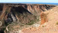 We drove up the Charles Knife Road to find a spot for lunch. The road was built originally to access Australia’s first oil well, back in the 1950s, but there wasn’t enough oil to exploit, so now it’s just a recreational road. It climbs into the Cape Range mountains between two canyons. At times, there is just the width of the road separating two cliffs that drop to the canyons’ depths. The road ends in a 4wd track that goes to an overlook of Shothole Canyon where we’d been a few days before. There’s a long hike from there to the head of the canyon, but we thought it was a bit too hot for that much exertion.
I stopped to take pictures of one of the canyons, felt some crawling on my thigh, and realized that my legs were smothered in ants, hundreds of them. I guess they just loved the salt from my swim! Luckily they didn’t bite or sting, but they took some getting rid of.
We rejoined the main road heading south towards Coral Bay, looking for the turn-off to Ningaloo Station. Eventually with help from the GPS we found the road, which had no sign posts, and bounced along its corrugations until we came to a rope gate, and then we were struggling with whom to pay and where to camp. We found our way over the hills and past the roos and sheep to the Ningaloo Station’s homestead, a collection of corrugated iron buildings. (Despite the similar names, Ningaloo Station is nothing like Waterloo Station! It’s a sheep station, with sheep pens and a shearing shed.)
An old lady came shuffling out with her walker. I paid our $5 fee for camping and she asked me to come in and fill out the “book” with our details. She gave me directions, and then we set off “over the two hills and around the shearing shed and through the metal gate” until we found our camping spot at the foot of the dunes.
Much of the land south of Cape Range is “pastoral”, leased from the government by sheep farmers. I think it is similar to the 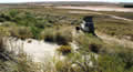 “Bureau of Land Management” land in the USA, except that the farmers in Australia are allowed to charge tourists for camping. Many Australians camp at the beaches on these stations in the winter for months at a time and for as little as $15 a week.
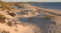
We climbed over the dunes to the beach at sunset. The Ningaloo Reef was still there, but further offshore. The water was calm behind the reef, and the beach was dotted with shells and pieces of coral. We realized that we had about five miles of golden beach to ourselves, just us and the sheep and the roos.
 Thursday July 27th
We awoke to the sound of sheep and surf: the wind had come up. I took a swim on our private beach, but the water was silty and not as inviting as the previous day. One of the arms on my glasses fell apart while I was swimming and I was lucky to keep all the pieces. I had my spare running/hiking glasses with me but they aren’t bifocals, so although I could see to walk and drive I couldn’t read anything up close.