2012/05 Western USA trip - Furnace Creek and Badwater |
|||||
Our rig was too long for us to drive some of the side roads but there was plenty to see on the main road. Our first stop was the Harmony Borax Works. Back in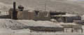 the 1880s, large deposits of borax ores were found in the valley and these were mined and carried out on wagons pulled by teams of twenty mules. They couldn’t afford to carry all the ore to the outside world so they built the refinery in the valley. I don’t know which would have been the worse job, loading the wagons or operating the boilers at the refinery. The Chinese workers lived next door to the refinery, too. The others lived at Furnace Creek, which didn’t sound much cooler!
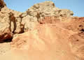 And it wasn’t. Furnace Creek has a visitor centre and a couple of hotels, and looked rather busy so we passed it by, going on to Golden
 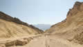 Canyon. This was a short walk through a gorgeous red and gold canyon. The sun was high enough by now to be blasting the whole canyon. It was a bit too hot for John but the rest of us got to the end and back.
The Devils Golf Course was a lot easier as we could drive there across the salt flats. The “golf course” is a vast area of 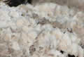
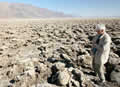 salt crystals, at all angles, so it’s painful to walk across. The bed of crystals is believed to be thousands of feet thick. Every year or so, water flows into the salt pan and then evaporates leaving more crystals.
Our last stop was at Badwater; famous as the lowest point on the continent, 282 feet below sea level. There was a small amount of open water there, on the edge of a vast plain of salt, blinding white under the sun. This area also gets flooded on the rare occasions when there is rain but it soon dries up leaving fresh hexagonal crystals. John and I walked out half mile or so to where 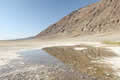 the crystals haven’t yet been crushed by feet. On the far side of the salt flats are the Panamint Mountains including Telescope Peak, at over
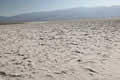 11000 feet. There’s a marker high on the cliff by the road showing where sea level is.
That was our last stop as we needed to find a campsite for the night. Our drive out of the park was quite scenic and very lonely. In eighty miles we saw four cars and a lone coyote. We passed through Shoshone, aiming for the hot springs at Tecopa Springs. The place looked to be half asleep, with a couple of expensive resorts which had few occupants. They’re probably busy with snowbirds during the winter, but things are really quiet in the summer season.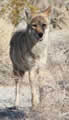
We found the campground we were looking for and the manager said she had the ideal spot for us. We followed her golf cart to an empty and desolate patch of gravel with some marking out for dozens of sites. We asked where the hot springs and pool were and she pointed down the hill. We looked and eventually realized we were looking at the sewage lagoon. Either she misunderstood or she had a weird sense of humour. We moved to another site to be further away from the lagoon and to hook up to electricity. Some of their plumbing worked OK, but the taps were all encrusted with salts so we didn’t take on any water.