2014/06 Haida Gwaii trip - Agate Beach |
|||||
It was still raining as we drove north to Masset and along to north coast to our next campsite at Agate Beach. This is at the other end of Naikoon park, but is only accessible from the Tlell end 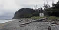 by walking the beach for a few days. Our route in was a gravel road, mostly wide enough for two cars, but narrow in places where big trees had been left in place.
We were camping right on the beach just above the high tide mark. In front of the camper, in the picture, is Tow Hill with the Blowhole among the rocks at the base of its cliffs. Looking out on the waters of Dixon Entrance to our left and the flat land on our right, we decided that our best tsunami plan would be to pour ourselves a last drink! Haida Gwaii sits right where the Pacific plate subducts under the North American one and it is Canada’s most seismic area; the last big earthquake was in 2012. It’s also exposed to tsunamis originating in Alaska, just across the water.
Tuesday June 24th
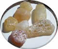
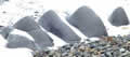
It was still raining but it eased off in late morning. Sandie found that the shingle beach really does have agates and quartz and citrine and jasper; these were some of the agates. She was collecting while I explored. The north end of the beach is dominated by the vertical cliffs of Tow Hill, a massive intrusion of volcanic columns. Below were rocks like miniature mountain ranges, mysterious until I realized they were fragments of columns eroded by millennia of waves. The far end of the beach was covered inches deep with rotting kelp, steep and slick enough to ski down (albeit by accident).
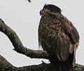
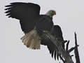 The rain stopped for a few minutes and we had a glimpse of sun, enough for this eagle to spread out its wings. It’s common for cormorants to do this but I’ve not seen an eagle hung out to dry before. The young eagle looks less than enthused about the weather.
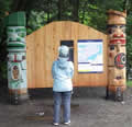 After lunch we walked around Tow Hill and took the boardwalk trail out to the Blowhole below the cliffs, close to where I’d walked in the morning. It was blowing some but
 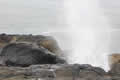 would have been better with a stronger swell. The volcanic rocks were unusually safe to walk on, with a surface like sandpaper. Above the rocks were great mounds of stunted but dense sitka spruce, impassable except for the boardwalk.
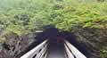
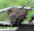
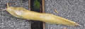 We took the elaborate boardwalk trail up to top of Tow Hill, with plenty of banana slugs for company, as well as these tiny birds, winter wrens I think. We had views of Rose Spit, the northernmost point of the park, and of Agate Beach stretching back towards Masset.
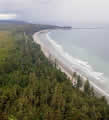 The picture shows us as a white dot on the beach, with a background of the next storm rolling in. Apparently there’s a view of Alaska’s Prince of Wales Island on a clear day but we didn’t have
 one. The rain started up again on our walk back down. The tide was now very low and crabbers were in the shallows with their nets and clammers were out on the sands, digging furiously with their shovels, in the rain.
Next