2004/02 New South Wales loop - Menindee |
|||
 The “major” road west varied enormously as it crossed different kinds of
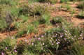
  ground. Mostly it was sand and rock but occasionally it became gooey black soil. The locals say that’s the worst stuff to drive on when it gets wet. We also came across fields full of flowers.
We made it to Brewarrina before dark, but found no campground there, so we drove on to Bourke (pronounced Burke). This used to be the last outpost of Australian civilization, and people used say “Back o’ Bourke” to mean the real wilderness.
Bourke’s only campground was closed, so we headed “back o’ Bourke” along the Kidman Way until we found a pull off where we could spend the night. Unfortunately, it’s also a spot that’s popular with the drivers of road trains, and by morning we shared it with four of those. The drivers leave them running while they sleep so we had a diesel lullaby that night. Luckily it was windy so the diesel fumes passed us by.
Monday March 1st
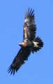
We left early as it wasn’t a great breakfast spot. As always, where there are road trains there are dead kangaroos along the road, and there were big wedge-tailed eagles feeding on them. We even saw a fox chasing the eagles off. Foxes were introduced from England and are now a major pest, so there are lots of efforts to poison them out, but this one looked to be doing OK. We also saw a father emu with six chicks in tow. Mother emus have no sense of responsibility.
The only town on the road was Cobar, once the site of a giant open-pit nickel mine, but now a prosperous country town. We found the local NSW Road Traffic Authority office there and got the promise of a refund of our camper’s unused license. We also refilled our propane bottle at a giant dimly-lit hardware store, rather like going into a 1950s Co-op.
We headed west along the Barrier Highway to Wilcannia, and then to save us a hundred miles of driving took the short-cut track along the Darling River to Menindee. The track was mainly sand and rock, but quite wide so it could be driven at speed, with the occasional lift-off when we hit the cattle grids. Much of the road was labeled “causeway” and we soon realized that this has a different meaning in New South Wales. Far from meaning a section of road that crosses the water, “causeway” there meant that when it rained, this section of the road was part of the river! Luckily there was little sign that it had rained in months. We saw no buildings in a hundred miles, though there were a few tracks that probably led off to distant farms.
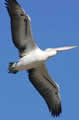 We were headed for Kinchega national park, famous for the birds that come to feed in the Menindee Lakes. The lakes get filled each year by the floods from the Darling River, and then they gradually evaporate until the Hancocks arrive. They weren’t quite dry. There was still some mud, considerable stink, and double the usual population of outback flies. It looked like there was water in the distance but it was a mirage. When we got there it looked like there was water where we had started from!