2007/09 Ontario trip - Pukaskwa |
|||
We had about 350 miles to cover to get to Pukaskwa, our next destination, so our intention was to make an early start, but of course there’s always something more to talk about, and it was late morning before we hit the road. We had a dull cloudy day with showers for the drive west along a corridor of trees to Wawa. That far north most of the trees are birches, so gold is the predominate colour, and even that was a bit thin as the trees were past their best. The road passes a number of interesting-looking provincial parks but they’d been closed for the season since Labour Day.
Wawa is the local word for “goose” and the town has more than its share of large and rather ugly goose sculptures adorning its restaurants and bars. We were now back on the TransCanada Highway, rounding Lake Superior, mostly well inland from the lake.
About 30 miles past Wawa I spotted the bar that I’d walked to back in 1989 when the Suburban’s top hose exploded on our way to Newfoundland. What had followed then was a tow into Wawa to pick up a four foot-long truck hose with the right size ends and then a drive back to the trailer in thick fog. We’d ended up camping at the side of the road in one of the most bug-infested spots ever: blackflies and mozzies working overlapping shifts. This time I realized how lucky I’d been to find that bar, as I think it’s the only building in about sixty miles, a very empty area.
The sun finally came out, just in time to hit us squarely in the eyes as we drove west along Superior’s north shore. We crossed the wide Pic River, drove through the reservation, and entered Pukaskwa at sunset, too late to do any exploring. The night time forecast for the area we’d just driven through was daunting, well below freezing, but we hoped that the wind off Lake Superior, which is just above freezing, would keep us a little warmer, and so it turned out.
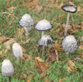 Saturday September 29th
We awoke to a sunny morning and the sounds of wind and surf; out of the shelter of the forest, the wind was coming really strongly off the lake. I walked across the sand dunes down to Horseshoe Bay, where the waves were pounding in. The scenery is quite different from that of Minnesota’s shore. Lake Superior was formed originally by a great rifting of the ancient granite and a pouring out of molten 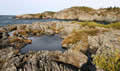 rock. Minnesota’s side of the lake got the lava, and has high cliffs of columnar volcanic rock and dozens of tumbling waterfalls, while Pukaskwa still has the original granite, with its softer, more rounded scenery and some wide and more peaceful rivers.
I took a trail over the rocks and down to Hattie’s Cove, a bay almost cut off from the rest of the lake. None of the waves was getting into the cove and it was protected from the wind, and it is probably one of the safest spots on the lake for canoeing. It’s likely that it warms up nicely in the summer too, maybe enough for swimming.
Next