2018/07 Arctic Part 1 - Inuvik |
|||||
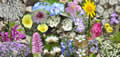 We were getting some welcome glimpses of sunshine. We stopped in a canyon to look at one flower and our stop turned into an hour of climbing around the canyon wall taking pictures. Some of these are captured in this composite.
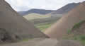 This was the view through the other end of the canyon, with the Richardson Mountains
  showing off their sensuous curves. Nearby was this display of strata.
On the north side of the mountains we could see ice in the valleys, places where the streams had backed up behind an ice dam and then frozen into a lake of ice, persisting into July.
We dropped down into the Peel River valley, part of the Mackenzie lowlands, an area warmed by all that water coming from the south. Trees grow in the lowlands: stunted spruce, birch, and tamarack. The Peel flows into the Mackenzie, as do the waters from BC’s Liard and Peace and Alberta’s Athabasca. The Mackenzie drains one fifth of Canada. 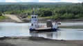
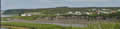 We took the cable ferry across the Peel River; this ferry is free, part of the road network. We passed the turning to Fort McPherson, one of the few towns in the area; we’d visit there on our way back.
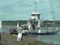
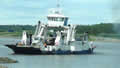 About an hour later we were lining up for the ferry across the Mackenzie River, over a half mile wide.. This is located just downstream of the confluence of the Mackenzie and the Arctic Red Rivers. The little Gwich’in village of Tsiigehtchic is perched on the wedge between the rivers. This ferry is free-running and the skipper has to deal with the strong currents of both rivers, spinning the ferry so that its ramp can land on a piece of riverbank at the right height. Looking at some of the vehicles struggling on and off I was thankful I wasn’t pulling a big trailer.
 |
Mackenzie ferry (1.23) |
 |
|---|
A nasty surprise was the cloud of bulldog flies, which we hadn’t encountered back in 2004, perhaps because that trip had been a month later. We were familiar with them though from our trip to the Great Slave Lake in 2013. They were a real problem for us in the area where the Mackenzie River flows out of the lake. And where were we now? In the Mackenzie Lowlands, about 600 miles downstream!
It’s my theory that bulldog flies evolved to eat the giant mammals: mammoths and mastodons and giant sloths, but now all that’s left for them are a few bison and musk oxen, so they go after anything similar, like our GMC truck. We’d found that they’d rarely bother us when hiking, but during those few minutes after parking and opening doors they will attack in force as if we were the soft bits of a giant metallic bison. We once had so many on the inside of the windshield that we couldn’t see!
Oh and why are they called bulldog flies? They don’t let go! They are horseflies with armour and you have to break them in half to unlatch them. There didn’t seem to be as many here but I was still bitten a couple of times. They don’t usually bother Sandie.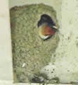
We were glad to see that there are swallows nesting in the ferry’s girders; they get to eat on both sides of the river without any effort. We wished them as many bulldog flies as they could eat.
We were now only a couple of hours from Inuvik and this area had obviously escaped the rains; the problem now was dust! Every vehicle was spewing a thick white cloud of dust behind it and, with no wind it would hang there for a long time. The locals must have radar as it doesn’t slow them down.
On a sunny afternoon it was now a very pleasant 25C (77F). We were looking for a place to camp before Inuvik, but places around 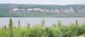 water were very buggy, with mosquitoes and bulldog flies. We came to a campground in Gwichin Territorial Park, perched on a crest overlooking Campbell Lake. We noted the large thunder cloud advancing across the lake and decided to camp there and then. See the weird light on the trees as the cloud covered us.
It’s an odd campground, with strange-shaped campsites and an elaborate kids’ playground. Camping cost $22.50 + tax, or $23.63, a difficult amount of change to accumulate and put in an envelope and force into a slot. Even more difficult for foreigners to understand, particularly as Canada has no one cent coins!
Even so, the view was great and we had the entire campground to ourselves. The rain was heavy but had little impact on our coating of mud. It was dark inside the camper with its blacked-out windows.
Wednesday July 4th
I tried to brush the mud off the windows but it had dried like paint. Luckily I’d packed our ice scraper (You never know when you’ll  need it!) and that worked fine. We had light again.
The weather was perfect, so we were going to make a brief stop in Inuvik to shop for food and then drive the new road from there to Tuktoyaktuk.
Inuvik is an odd place, a “new town” created by the government, mostly in the 1960s. It was designed to replace the existing administrative centre of Avvavik, which had no room for expansion and was prone to flooding. Most building materials came in by barge as the Dempster Highway wasn’t completed for another twenty years.
We came to the airport and then bounced our way to Inuvik. The road from the airport to town is notorious for its massive ripples; it was built before the Dempster and before there was much understanding of how to build roads on permafrost.
We shopped at the General Store, which lived up to its name and sold everything that you’d expect to find in a department store and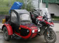 a supermarket. We were there for just a few groceries. I met an Alaskan motorcyclist outside the store. He had just come back from Tuktoyaktuk. His advice was to go while the road was dry as it can be undrivable when wet; it had been closed numerous times in the spring. Even in the dry it was difficult; he thought they’d used pea gravel, too small. His tyres had been squirming through it.