2018/07 Arctic Part 1 - Tuktoyaktuk |
|||||
It was time to drive the 80 miles to Tuktoyaktuk, but where was the new road? There were no signs in town yet. Our GPS took us down to the boat launch on the Mackenzie River and we realized that it was taking us via the ice road, not a good idea in summer!
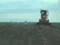
Finally, we saw two teenagers standing next to signs asking for a ride to Tuk. We thought they must know where to stand and we 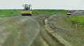 followed that road. The road was good for a little while then we came to where two women were driving road rollers and beyond there was about 15 miles of mud. For a new road it was appalling, just not enough gravel for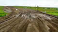
the job. Our truck has four-wheel drive and that helps with direction, but our dual rear wheels are a problem. Their advantage is that we can run tyres at a comfortable 60 psi versus a single tyre at 90 psi, but in deep snow or mud we’d be better off with a single tyre that could penetrate the mud rather than a pair that floats across it.
 |
Road to Tuktoyaktuk (0.54) |
 |
|---|
The road eventually improved and we were able to look at the scenery. The road crosses the Mackenzie Delta, a maze of channels 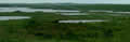
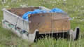 and islands. It follows the contours of the land and has an economy of bridges, so it winds around lakes, up and down the hills, but never far above river level. There were, of course, no houses but there were a few sleds scattered along the side of the road. We’d seen similar in Labrador and thought those had been for transporting firewood, but there were few trees to cut here. Perhaps
  they’re used for hunting,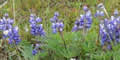
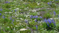
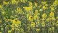
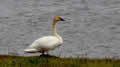
As usual we made many stops for flowers. There were a few ducks and tundra swans too.
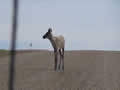
Then we saw a figure on the road at the top of a hill and it came down the slope towards us. We had no idea what it was until it turned sideways and we could see it was a caribou. We’d like to have seen thousands flowing over the tundra but we’d settle for one. This one seemed to be c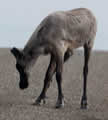 onfused
 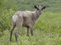 about what we were and it came much closer than it should and then wavered to and fro before trotting off into the bushes.
|
Caribou (1.02) |
 |
|---|
There are no rest areas or parking places on the road, so we stopped for coffee in a slow vehicle lane, not that there are any lane markings on a gravel road.. We were probably the slowest vehicle around anyway.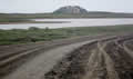
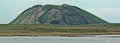 As we got closer to Tuk we began seeing pingos in the distance. These are cones of ice, some hundreds of feet high. Pingos form when there is a spring coming up below permafrost. The water forms a lake and the edges then freeze to the ground. When the centre freezes it is forced up. Repeat for thousands of seasons and you have a cone of ice, a pingo.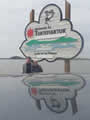
We came to more roadworks. The motorcyclist had warned us that they were particularly bad but the road had dried and we just took it slowly.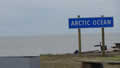
We came to this Land of the Pingos sign, with a view of two giant pingos on the horizon. The water beside the road was a little salty. We had made it to the Arctic Ocean, truly Canada’s Far North! But how far north were we? Well, we were 1400 miles north of Hope and 500 miles north of the Alaska Highway. But we were still 1400 miles south of the geographic North Pole. Most of Nunavut was to the north of us, including the hamlet of Alert, just 500 miles from the pole. There is no road access to Nunavut from the Canadian mainland.
The entrance to Tuktoyaktuk is not pretty. The town itself is a fishing community, mostly on a peninsula at the end of the road, and everything industrial or unpleasant is located out of town and away from people. We were entering past the extensive rubbish dump, oil storage tanks, power station, and the airport runway.
Tuk has a 15kph (10 mph) speed limit so we tried to be good visitors but the locals were blasting past and around us. Our first impression was that the place was amazingly busy for a village of less than a thousand people. Trucks and cars, motorcycles and ATVs were buzzing up and down the main street.
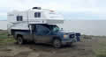 There is no official campground in Tuk but visitors are allowed camp on the beach at The Point, the tip of the peninsular, looking out over the Arctic Ocean.
Our plan was to stay for a couple of nights and explore the town and the area. 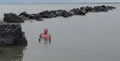
That wasn’t how things worked out, but that’s a story for the next part of this journal. For now, here is a picture of our campsite on the beach and another of my Arctic swim at the far tip of the peninsula.